Polar regions
Earth's frigid zones surrounding the North and South Poles.

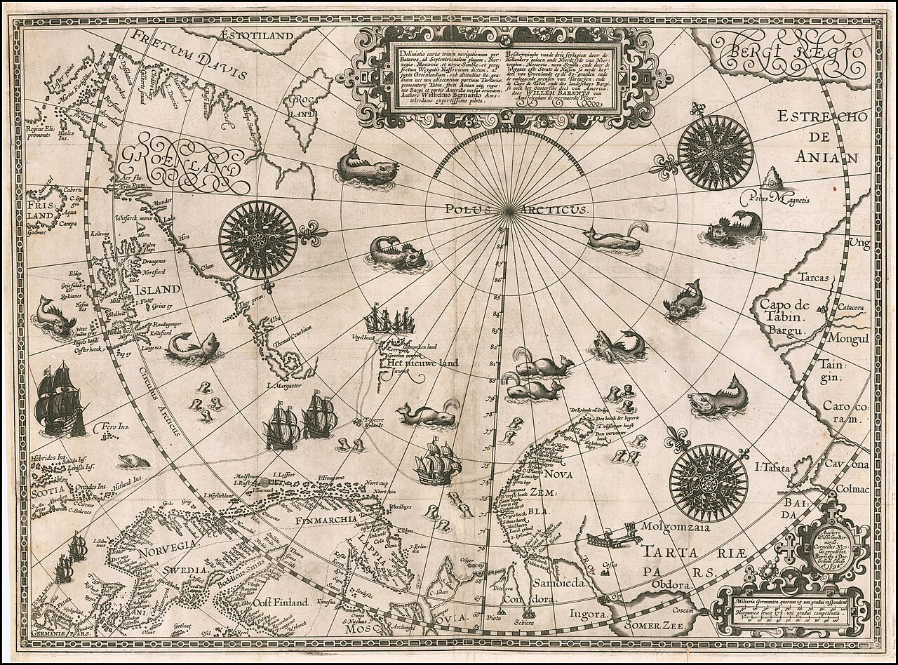
Original charts by Willem Barentsz, map drawn by Cornelis Claesz ("Cornelius Nic · Public domain
The polar regions, also called the frigid zones or polar zones, are Earth's polar ice caps surrounding the geographical North and South Poles, lying within the polar circles. These high-latitude areas are dominated by floating sea ice in the Arctic Ocean and by the Antarctic ice sheet on the continent of Antarctica and the Southern Ocean.
- field
- Geography and climate
- known_for
- Extremely cold temperatures, heavy glaciation, extreme daylight variations, and minimal solar radiation
- north_pole_region
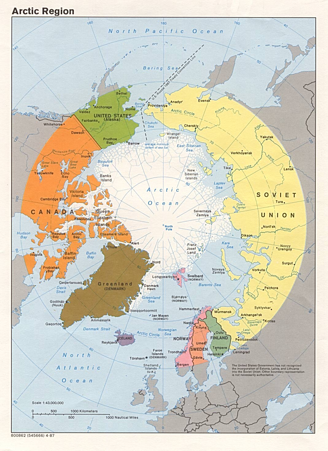
- Arctic, with settlements and claims by the United States, Canada, Denmark, Norway, Finland, Sweden, Iceland, and Russia
- south_pole_region
- Antarctica, with no permanent human habitation; research stations include McMurdo Station, Palmer Station, Amundsen–Scott South Pole Station, Esperanza Base, Marambio Base, Scott Base, and Vostok Stat
Lore & Background
The polar regions receive less intense solar radiation than other parts of Earth because the Sun's energy arrives at an oblique angle, spreading over a larger area and traveling a longer distance through the atmosphere. The axial tilt of Earth, at 23.5°, has the most effect on polar climate, but because these regions are farthest from the equator, they receive the weakest solar radiation and are generally frigid year round. Large amounts of ice and snow further reflect and weaken the sunlight, contributing to the cold.
Reader's Guide
The polar regions are significant as Earth's coldest and most extreme climatic zones, characterized by heavy glaciation, short cold summers, and extreme variations in daylight hours—twenty-four hours of daylight in summer and complete darkness at mid-winter. The Arctic region supports diverse human settlements and cultures, with countries such as the United States, Canada, Denmark, Norway, Finland, Sweden, Iceland, and Russia claiming territories. In contrast, the Antarctic region has no permanent human habitation but hosts research stations operated by the United States, Argentina, New Zealand, and Russia. The Antarctic coastal ecosystem is complex, with upwelling nutrients feeding krill, which in turn support creatures from penguins to blue whales. The 1959 Antarctic Treaty defines the Antarctic as south of 60° south latitude. These regions are distinguished from the tropics and middle latitude belts and are critical for understanding global climate patterns and cryospheric processes.
Did You Know?
- The Arctic has various definitions, including north of the Arctic Circle (66°33'44" N), north of 60° north latitude, or from the North Pole south to the timberline.
- The Antarctic is usually defined as south of 60° south latitude or the continent of Antarctica, as per the 1959 Antarctic Treaty.
- McMurdo Station is the largest research station in Antarctica, run by the United States.
- Coastal upwelling in Antarctica provides abundant nutrients that feed krill, which in turn feed penguins and blue whales.
Geography & Physical Scale
Oceania occupies a unique position at the centre of what is called the water hemisphere, stretching across both the Eastern and Western hemispheres. Its total land area is roughly nine million square kilometres, making it the smallest of Earth's continental groupings. The geographic boundaries of Oceania are notably diffuse, with islands at its extremes spanning from the Bonin Islands, a politically integral part of Japan, to Hawaii, a U.S. state, Clipperton Island, a French possession, Rapa Nui belonging to Chile, and Macquarie Island, an Australian territory. This scattered, ocean-bound geography is precisely what distinguishes Oceania from other continental regions.
Deep Time & European Contact
The human story of Oceania stretches back more than sixty thousand years, when the first peoples reached the coasts of Australia, New Guinea, and the large islands to the east. For tens of millennia, the surrounding ocean acted as a natural barrier, insulating these island communities from the cultural currents that swept across larger continental landmasses. This isolation helped preserve distinct traditions, including the rock art of Aboriginal Australians, which stands as the longest continuously practised artistic tradition on Earth. Spanish, Dutch, British, and French explorers followed in subsequent decades. James Cook's first voyage brought him to Tahiti and along the eastern seaboard of Australia for the first time, and later to the Hawaiian Islands. The centuries of European settlement that followed reshaped the social and political fabric of the region, and the Pacific became a significant theatre of military action during both World Wars.
A Spectrum of Development
Within a single geographic region, Oceania encompasses an extraordinary range of economic and social outcomes. On one end sit the highly developed, globally competitive economies of Australia, New Zealand, French Polynesia, Hawaii, and New Caledonia, all of which rank highly on quality-of-life and Human Development Index measures. Australia, the largest and most populous nation in the region, anchors this tier, with Sydney serving as its largest city. At the other extreme, nations such as Kiribati, Papua New Guinea, Tuvalu, Vanuatu, and Western New Guinea operate with far more limited economic infrastructure and development. This stark contrast exists within a shared maritime space where most countries function as parliamentary democracies. For the smaller Pacific island states, tourism represents a vital pillar of national income, making their economic fortunes closely tied to global travel patterns and environmental conditions. The region's diversity means that no single narrative of progress or challenge can capture the full picture of life across its many islands and territories.
Naming, Classification & Scholarly Debate
The very name Oceania carries a story of intellectual history. The term was chosen deliberately because, unlike other continental groupings, it is the sea rather than land that binds the region's parts together. For much of the nineteenth century, Western geographers and cartographers subdivided the Pacific using categories that were often rooted in racial typologies: Australasia, Malesia, Melanesia, Micronesia, and Polynesia. Since the early 1990s, many scholars have adopted Green's terminology, though the traditional subdivisions persist in scientific literature, popular culture, and everyday usage. Despite its significance, Oceania has often been treated as a marginal afterthought in global historical narratives.
Gallery
Frequently Asked Questions
What are Polar regions?
Polar regions refer to Earth's frigid zones—the high-latitude areas within the polar circles that surround the geographical North and South Poles. They encompass the Arctic ice cap in the north and the Antarctic ice sheet plus surrounding Southern Ocean in the south.
What are Polar regions known for?
They are defined by brutally cold temperatures, massive glaciation, dramatic swings between near-constant daylight and darkness, and very low incoming solar radiation. These conditions make them some of the most extreme environments on the planet.
Who has settlements or claims in the Polar regions?
The Arctic (North Pole region) hosts human settlements and is subject to territorial claims by the United States, Canada, Denmark, Norway, Finland, Sweden, Iceland, and Russia. In contrast, the Antarctic (South Pole region) has no permanent residents, only rotating research personnel.
Which research stations operate in the Polar regions?
Notable facilities include McMurdo Station, Palmer Station, the Amundsen–Scott South Pole Station, Esperanza Base, Marambio Base, Scott Base, and Vostok Station. These outposts support year-round scientific work on ice, atmosphere, and marine biology.
Why are Polar regions important?
They act as a natural laboratory for studying climate dynamics, glacial history, and extreme-environment biology. Because their ice and sea-ice cover respond quickly to warming, they also serve as early-warning indicators of global environmental change.
More in Regions & Cultural Spheres 25-29
Elsewhere in the Regions & Cultural Spheres universe
Spotted an error? Know more?
This is a living reference — every entry is fact-audited, and reader corrections feed straight into our audit queue. Suggest an edit · See this site's audit record